Top Features:
1.Powerful graphical surveying
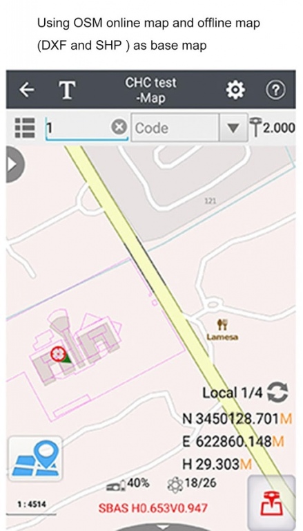
Support both OSM (Open Street Map) online map and offline map (DXF and ESRI SHP file formats) as the base map. Selected points in a DXF or SHP file can be automatically coordinated and added to the points manager for staking. Multiple line and polygon features are allowed to measure simultaneously.
2.Extensive data import and export formats
Support CSV, DAT, TXT, DXF, SHP and NCN as the import format, CSV, DAT, TXT, KML, DXF, SHP, RAW, HTML as the export format. Contents of CSV, DAT, TXT can be customized by users.
3.Multiple localization methods
Supports 3, 4, 7 parameter based three dimensional Cartesian transformation methods. Enables to use Geoid undulation file(GGF)[ BIN, GRD, GSF, GRI and ASC geoid and grid shift file formats will available soon] and also Grid shift file. Support for RTCM transformation messages (1021-1027).
4.Correction repeater function
Supports repeating correction data from RTK network to other rovers via the internal radio modem.
5.Convenient work mode management
Supports presetting of common work modes, selecting or switching work modes by one button push. You will not need additional steps to configure your work mode while surveying.
6.Various types of measurement
Support points, lines, polygons and PPK measurement. The methods of point measurement include topographic point, control point, continuous point, eccentric point and compensate point.
7.Multiple types of stakeout
Support point stakeout, line stakeout, surface stakeout and road stakeout.
8.Three connection types
Support Bluetooth, WIFI and demonstration connection. Demonstration module allows users to input the coordinates and simulate it as the current position.
9.Smart e-manual
Embedded e-manual is available on the field. You can check the help documentation in the top right corner of the interface and get guide of each function.
10.RAW file recording
Supports to write RAW files. You can review the operation procedures, configuration parameters and measurement results.
11.Measurement geofencing
Supports a series of points as the measurement geofencing. It will remind you once your position goes out of the boundary to ensure user’s work being limited in a predetermined area.
12.Real-time global TEC map
Supports a built-in global TEC map with updating every 10 minutes to help you to choose the best working time in high ionospheric activity regions.
13.Powerful COGO tools
Support calculation of perimeters, areas, transformation parameters, etc. It also has a build-in RPN calculator so that you can do common calculations conveniently in the field.
14.Field Hardware Support
Supports CHC X91+/X900+ receiver with the firmware v8.33 and above, and CHC i80 receiver with the firmware v1.3.42 and above, as well as internal GPS of Android smartphone and handheld controller.
15.Data Collection Hardware
LandStar7 can operate on CHC HCE300 handheld controller comes with permanent registration code and Android device with OS v4.2 and above which need additional registration code provided by CHC.
16.Language support
LandStar7 is available in English, Russian, Turkish, Korean, Finnish, German, Traditional Chinese and Simplified Chinese.
We do not host LandStar7 on our servers. We did not scan it for viruses, adware, spyware or other type of malware. This app is hosted by Galad and passed their terms and conditions to be listed there. We recommend caution when installing it.
The APK Download link for LandStar7 is provided to you by apps112.com without any warranties, representations or guarantees of any kind, so access it at your own risk.
If you have questions regarding this particular app contact the publisher directly. For questions about the functionalities of apps112.com contact us.

|
| ||||
| Downloads: 210 | ||||
| Updated At: 2024-04-23 09:59:55 | ||||
| Publisher: www.chcnav.com | ||||
| Operating System: Android | ||||
| License Type: Free |